Weather Alert in Georgia
Flood Warning issued August 2 at 6:43PM EDT until August 2 at 8:15PM EDT by NWS Charleston SC
AREAS AFFECTED: Chatham, GA
DESCRIPTION: * WHAT...Flooding caused by excessive rainfall is expected. * WHERE...A portion of southeast Georgia, including the following county, Chatham. * WHEN...Until 815 PM EDT. * IMPACTS...Expect many areas of slow moving or standing water. * ADDITIONAL DETAILS... - At 641 PM EDT, Doppler radar indicated only light rain falling over central Chatham County. While no additional flash flooding is expected, many areas remain flooded around the Windsor Forest, Hunter Army Airfield and Downtown Savannah areas. It will take a bit longer for flood waters to recede. Remember, never drive into flooded areas! - Some locations that will experience flooding include... Windsor Forest, Hunter Army Airfield, Coffee Bluff, Midtown Savannah, Downtown Savannah, Montgomery, Garden City, Thunderbolt and Vernonburg. - This includes the following highways... I-16 near mile marker 162. I-95 in Georgia between mile markers 96 and 97. I-516 between mile markers 3 and 4.
INSTRUCTION: Turn around, don't drown when encountering flooded roads. Most flood deaths occur in vehicles.
Want more detail? Get the Complete 7 Day and Night Detailed Forecast!
Current U.S. National Radar--Current
The Current National Weather Radar is shown below with a UTC Time (subtract 5 hours from UTC to get Eastern Time).

National Weather Forecast--Current
The Current National Weather Forecast and National Weather Map are shown below.

National Weather Forecast for Tomorrow
Tomorrow National Weather Forecast and Tomorrow National Weather Map are show below.

North America Water Vapor (Moisture)
This map shows recent moisture content over North America. Bright and colored areas show high moisture (ie, clouds); brown indicates very little moisture present; black indicates no moisture.

Weather Topic: What is Drizzle?
Home - Education - Precipitation - Drizzle
 Next Topic: Evaporation
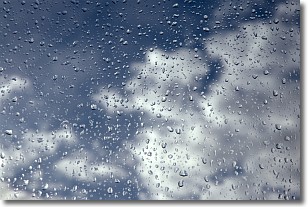
Drizzle is precipitation in the form of water droplets which are
smaller than raindrops.
Drizzle is characterized by fine, gently falling droplets and typically does not
impact human habitation in a negative way. The exception to this is freezing drizzle,
a condition where drizzle freezes immediately upon reaching earth's surface.
Freezing drizzle is still less dangerous than freezing rain, but can
potentially result in hazardous road conditions.
Next Topic: Evaporation
Weather Topic: What is Fog?
Home - Education - Cloud Types - Fog
 Next Topic: Fractus Clouds
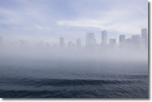
Fog is technically a type of stratus cloud, which lies along the
ground and obscures visibility.
It is usually created when humidity in the air condenses into tiny water droplets.
Because of this, some places are more prone to foggy weather, such as regions
close to a body of water.
Fog is similar to mist; both are the appearance of water droplets suspended in
the air, but fog is the term applied to the condition when visibility is less than 1 km.
Next Topic: Fractus Clouds
Current conditions powered by WeatherAPI.com


