Weather Alert in New Mexico
Fire Weather Watch issued March 31 at 12:44PM MDT until April 2 at 9:00PM MDT by NWS Albuquerque NM
AREAS AFFECTED: Northeast Plains; Northeast Highlands; Central Highlands; East Central Plains
DESCRIPTION: ...FIRE WEATHER WATCH THURSDAY FROM 2 PM UNTIL 9 PM ACROSS THE NORTHEAST HIGHLANDS AND PLAINS, CENTRAL HIGHLANDS, AND EAST CENTRAL PLAINS DUE TO STRONG WIND AND LOW HUMIDITY... .An upper level trough passing to the north of New Mexico will strengthen the flow aloft on Thursday, and a potent surface trough will develop in the lee of the southern Rockies strengthening downslope winds while humidities plummet. Wind speeds will weaken during the evening and humidities will climb, easing fire weather concerns. The National Weather Service in Albuquerque has issued a Fire Weather Watch...which is in effect from Thursday afternoon through Thursday evening. * AREA AND TIMING...Northeast Highlands (Zone 123), Northeast Plains (Zone 104), Central Highlands (Zone 125), and East Central Plains (Zone 126). * 20 FOOT WINDS...Southwest 15 to 30 mph with gusts up to 45 mph. Strongest winds will be along and north of I-40. * RELATIVE HUMIDITY...Minimum values 9-15 percent. * IMPACTS...Any fires that develop will likely spread rapidly. Outdoor burning is not recommend.
INSTRUCTION: Please advise the appropriate officials or fire crews in the field of this Fire Weather Watch.
Want more detail? Get the Complete 7 Day and Night Detailed Forecast!
Current U.S. National Radar--Current
The Current National Weather Radar is shown below with a UTC Time (subtract 5 hours from UTC to get Eastern Time).

National Weather Forecast--Current
The Current National Weather Forecast and National Weather Map are shown below.

National Weather Forecast for Tomorrow
Tomorrow National Weather Forecast and Tomorrow National Weather Map are show below.

North America Water Vapor (Moisture)
This map shows recent moisture content over North America. Bright and colored areas show high moisture (ie, clouds); brown indicates very little moisture present; black indicates no moisture.

Weather Topic: What is Sleet?
Home - Education - Precipitation - Sleet
 Next Topic: Snow
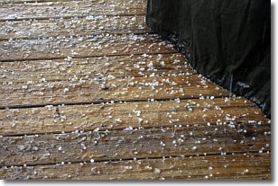
Sleet is a form of precipitation in which small ice pellets are the primary
components. These ice pellets are smaller and more translucent than hailstones,
and harder than graupel. Sleet is caused by specific atmospheric conditions and
therefore typically doesn't last for extended periods of time.
The condition which leads to sleet formation requires a warmer body of air to be
wedged in between two sub-freezing bodies of air. When snow falls through a warmer
layer of air it melts, and as it falls through the next sub-freezing body of air
it freezes again, forming ice pellets known as sleet. In some cases, water
droplets don't have time to freeze before reaching the surface and the result is
freezing rain.
Next Topic: Snow
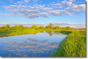
Weather Topic: What are Stratocumulus Clouds?
Home - Education - Cloud Types - Stratocumulus Clouds
 Next Topic: Stratus Clouds
Stratocumulus clouds are similar to altocumulus clouds in their
fluffy appearance, but have a slightly darker shade due to their additional mass.
A good way to distinguish the two cloud types is to hold your hand out and measure
the size of an individual cloud; if it is the size of your thumb it is generally
an altocumulus cloud, if it is the size of your hand it is generally a
stratocumulus cloud.
It is uncommon for stratocumulus clouds to produce precipitation, but if they do
it is usually a light rain or snow.
Next Topic: Stratus Clouds
Current conditions powered by WeatherAPI.com


