Weather Alert in Minnesota
Winter Weather Advisory issued April 1 at 3:11AM CDT until April 2 at 12:00PM CDT by NWS Twin Cities/Chanhassen MN
AREAS AFFECTED: Sherburne; Isanti; Chisago; Wright; Hennepin; Anoka; Ramsey; Renville; McLeod; Sibley; Carver; Redwood; Brown; Nicollet; Watonwan; Blue Earth; Waseca; Steele
DESCRIPTION: ...MESSY SPRING SYSTEM BRINGS FREEZING RAIN, SLEET, AND SNOWTO PORTIONS OF MINNESOTA AND WISCONSIN TONIGHT THROUGH THURSDAY... .A strong spring system brings a variety of precipitation types to the region tonight through Thursday. While there is still some uncertainty in the exact track of the low, mainly snow & sleet is expected across central Minnesota, while a mix of freezing rain, sleet, & snow is expected for southern Minnesota, the Twin Cities metro, & western Wisconsin. The greatest travel impacts are expected across eastern Minnesota & west-central Wisconsin where icing amounts around 0.25" are likely, along with sleet & snow at times. This will lead to very slick roads, as well as the possibility of some downed tree branches & power outages. Elsewhere, freezing rain accumulations around 0.1" along with an inch or two of sleet & snow will lead to slick roads late Wednesday night through Thursday morning. * WHAT...Mixed precipitation expected. Total snow accumulations up to one inch, sleet accumulations around one half of an inch, and ice accumulations up to two tenths of an inch. * WHERE...Portions of central, east central, south central, and southwest Minnesota. * WHEN...From midnight tonight to noon CDT Thursday. * IMPACTS...Plan on slippery road conditions. The hazardous conditions will impact the Thursday morning commute.
INSTRUCTION: Slow down and use caution while traveling. Call 5 1 1 or visit 511mn.org for road conditions. Be prepared for slippery roads. Slow down and use caution while driving. If you are going outside, watch your first few steps taken on stairs, sidewalks, and driveways. These surfaces could be icy and slippery, increasing your risk of a fall and injury.
Want more detail? Get the Complete 7 Day and Night Detailed Forecast!
Current U.S. National Radar--Current
The Current National Weather Radar is shown below with a UTC Time (subtract 5 hours from UTC to get Eastern Time).

National Weather Forecast--Current
The Current National Weather Forecast and National Weather Map are shown below.

National Weather Forecast for Tomorrow
Tomorrow National Weather Forecast and Tomorrow National Weather Map are show below.

North America Water Vapor (Moisture)
This map shows recent moisture content over North America. Bright and colored areas show high moisture (ie, clouds); brown indicates very little moisture present; black indicates no moisture.

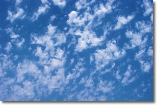
Weather Topic: What are Fractus Clouds?
Home - Education - Cloud Types - Fractus Clouds
 Next Topic: Freezing Rain
A fractus cloud (scud) is a fragmented, tattered cloud which has
likely been sheared off of another cloud. They are accessory clouds, meaning they
develop from parent clouds, and are named in a way which describes the original
cloud which contained them.
Fractus clouds which have originated from cumulus clouds are referred to as
cumulus fractus, while fractus clouds which have originated from stratus clouds
are referred to as stratus fractus. Under certain conditions a fractus cloud might
merge with another cloud, or develop into a cumulus cloud, but usually a
fractus cloud seen by itself will dissipate rapidly.
They are often observed on the leading and trailing edges of storm clouds,
and are a display of wind activity.
Next Topic: Freezing Rain
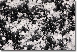
Weather Topic: What is Graupel?
Home - Education - Precipitation - Graupel
 Next Topic: Hail
Graupel is a form of precipitation that is created by atmospheric conditions
which cause supercooled water droplets to contact snow crystals and freeze to
their surface.
Sometimes known as soft hail or snow pellets, graupel is delicate and easily
destroyed by touch. Whereas hail usually falls during severe weather, graupel
doesn't require such conditions to form, and can form in mild precipitation
similar to situations which produce snowfall.
Next Topic: Hail
Current conditions powered by WeatherAPI.com


