Weather Alert in Ohio
Flood Warning issued April 1 at 10:10PM EDT until April 2 at 9:30PM EDT by NWS Cleveland OH
AREAS AFFECTED: Hancock, OH
DESCRIPTION: ...The Flood Warning is extended for the following rivers in Ohio... Portage River At Woodville affecting Sandusky and Wood Counties. Huron River Near Milan affecting Erie County. Cuyahoga River At Old Portage affecting Summit County. Blanchard River Near Findlay affecting Hancock County. Maumee River At Waterville affecting Lucas and Wood Counties. Killbuck Creek Near Killbuck affecting Holmes and Wayne Counties. ...The Flood Warning continues for the following rivers in Ohio... Sandusky River At Tiffin affecting Seneca County. Black River At Elyria affecting Lorain County. Mahoning River At Youngstown affecting Mahoning and Trumbull Counties. Eagle Creek Above Findlay affecting Hancock County. Eagle Creek At Phalanx Station affecting Trumbull County. For the Portage River...including Woodville...Minor flooding is forecast. For the Sandusky River...including Upper Sandusky, Fremont, Tiffin, Bucyrus...Minor flooding is forecast. For the Huron River...including Milan...Minor flooding is forecast. For the Black River...including Elyria...Minor flooding is forecast. For the Cuyahoga River...including Hiram Rapids, Jaite, Old Portage, Independence...Minor flooding is forecast. For the Blanchard River...including Findlay...Minor flooding is forecast. For the Maumee River...including Grand Rapids, Waterville...Minor flooding is forecast. For the Killbuck Creek...including Killbuck...Minor flooding is forecast. For the Mahoning River...including Leavittsburg, Warren, Youngstown...Minor flooding is forecast. For the Eagle Creek (Hancock)...including Findlay...Minor flooding is forecast. For the Eagle Creek (Trumbull)...including Phalanx Station...Minor flooding is forecast. * WHAT...Minor flooding is occurring and minor flooding is forecast. * WHERE...Blanchard River near Findlay. * WHEN...From this evening to late tomorrow evening. * IMPACTS...At 13.0 feet, North Cory flooded from Washington to High Street including Meeks and Seneca Avenue. Roads south of Clinton Court flooded between South Blanchard Street and McManness Avenue. East Main Cross from Marcelle Avenue to Bright Road. County Road 236 near Little Red Schoolhouse to County Road 568. * ADDITIONAL DETAILS... - At 9:00 PM EDT Wednesday the stage was 12.0 feet. - Forecast...The river is expected to rise to a crest of 12.6 feet tomorrow morning. It will then fall below flood stage tomorrow afternoon. - Flood stage is 12.0 feet. - Please visit www.weather.gov/safety/flood for flood safety and preparedness information.
INSTRUCTION: Turn around, don't drown when encountering flooded roads. Most flood deaths occur in vehicles. Additional information is available at www.weather.gov/cle. The next statement will be issued Thursday morning at 600 AM EDT.
Want more detail? Get the Complete 7 Day and Night Detailed Forecast!
Current U.S. National Radar--Current
The Current National Weather Radar is shown below with a UTC Time (subtract 5 hours from UTC to get Eastern Time).

National Weather Forecast--Current
The Current National Weather Forecast and National Weather Map are shown below.

National Weather Forecast for Tomorrow
Tomorrow National Weather Forecast and Tomorrow National Weather Map are show below.

North America Water Vapor (Moisture)
This map shows recent moisture content over North America. Bright and colored areas show high moisture (ie, clouds); brown indicates very little moisture present; black indicates no moisture.

Weather Topic: What are Cumulonimbus Clouds?
Home - Education - Cloud Types - Cumulonimbus Clouds
 Next Topic: Cumulus Clouds
The final form taken by a growing cumulus cloud is the
cumulonimbus cloud, which is very tall and dense.
The tower of a cumulonimbus cloud can soar 23 km into the atmosphere, although
most commonly they stop growing at an altitude of 6 km.
Even small cumulonimbus clouds appear very large in comparison to other cloud types.
They can signal the approach of stormy weather, such as thunderstorms or blizzards.
Next Topic: Cumulus Clouds
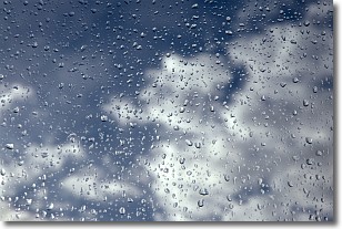
Weather Topic: What is Drizzle?
Home - Education - Precipitation - Drizzle
 Next Topic: Evaporation
Drizzle is precipitation in the form of water droplets which are
smaller than raindrops.
Drizzle is characterized by fine, gently falling droplets and typically does not
impact human habitation in a negative way. The exception to this is freezing drizzle,
a condition where drizzle freezes immediately upon reaching earth's surface.
Freezing drizzle is still less dangerous than freezing rain, but can
potentially result in hazardous road conditions.
Next Topic: Evaporation
Current conditions powered by WeatherAPI.com


