Weather Alert in Ohio
Flood Advisory issued March 31 at 11:18PM EDT until April 1 at 2:00AM EDT by NWS Cleveland OH
AREAS AFFECTED: Erie, OH; Lorain, OH
DESCRIPTION: * WHAT...Flooding caused by excessive rainfall is ongoing. * WHERE...A portion of north central Ohio, including the following counties, Erie and Lorain. * WHEN...Until 200 AM EDT. * IMPACTS...Minor flooding in low-lying and poor drainage areas. Water over roadways. * ADDITIONAL DETAILS... - At 1117 PM EDT, local law enforcement reported heavy rain in the advisory area due to thunderstorms. Minor flooding has been reported on some roads across the area. Minor flooding is ongoing. Between 1 and 2 inches of rain have fallen. - Additional rainfall amounts up to 0.5 inches are expected over the area. This additional rain will result in minor flooding. - Some locations that will experience flooding include... Lorain, Elyria, Sandusky, Vermilion, Western Vermilion, Westlake, North Ridgeville, Avon Lake, Amherst, Grafton, Northern Milan, Castalia, North Olmsted, Avon, Sheffield Lake, Eaton, Oberlin, Sheffield, Lagrange and South Amherst. - Please visit www.weather.gov/safety/flood for flood safety and preparedness information.
INSTRUCTION: Turn around, don't drown when encountering flooded roads. Most flood deaths occur in vehicles. Be especially cautious at night when it is harder to recognize the dangers of flooding.
Want more detail? Get the Complete 7 Day and Night Detailed Forecast!
Current U.S. National Radar--Current
The Current National Weather Radar is shown below with a UTC Time (subtract 5 hours from UTC to get Eastern Time).

National Weather Forecast--Current
The Current National Weather Forecast and National Weather Map are shown below.

National Weather Forecast for Tomorrow
Tomorrow National Weather Forecast and Tomorrow National Weather Map are show below.

North America Water Vapor (Moisture)
This map shows recent moisture content over North America. Bright and colored areas show high moisture (ie, clouds); brown indicates very little moisture present; black indicates no moisture.

Weather Topic: What is Condensation?
Home - Education - Precipitation - Condensation
 Next Topic: Contrails
Condensation is the process which creates clouds, and therefore
it is a crucial process in the water cycle.
Condensation is the change of matter from a state of gas into a state of liquid,
and it happens because water molecules release heat into the atmosphere and
become organized into a more closely packed structure, what we might see as
water droplets.
Water is always present in the air around us as a vapor, but it's too small for
us to see. When water undergoes the process of condensation it becomes organized
into visible water droplets. You've probably seen condensation happen before on the
surface of a cold drink!
Next Topic: Contrails
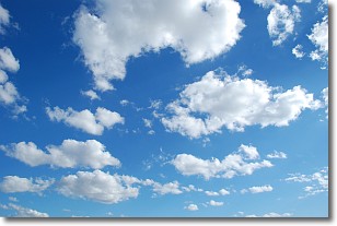
Weather Topic: What are Cumulonimbus Clouds?
Home - Education - Cloud Types - Cumulonimbus Clouds
 Next Topic: Cumulus Clouds
The final form taken by a growing cumulus cloud is the
cumulonimbus cloud, which is very tall and dense.
The tower of a cumulonimbus cloud can soar 23 km into the atmosphere, although
most commonly they stop growing at an altitude of 6 km.
Even small cumulonimbus clouds appear very large in comparison to other cloud types.
They can signal the approach of stormy weather, such as thunderstorms or blizzards.
Next Topic: Cumulus Clouds
Current conditions powered by WeatherAPI.com


