Weather Alert in Montana
Winter Storm Watch issued March 31 at 12:51PM MDT until April 3 at 12:00PM MDT by NWS Great Falls MT
AREAS AFFECTED: Cascade County below 5000ft; Judith Basin County and Judith Gap; Fergus County below 4500ft; Little Belt and Highwood Mountains; Snowy and Judith Mountains; Big Belt, Bridger and Castle Mountains; Gallatin and Madison County Mountains and Centennial Mountains
DESCRIPTION: * WHAT...Heavy, wet snow possible. Total snow accumulations between 4 and 8 inches possible at elevations below 5,000 feet and 8 to 16 inches possible above 5,000 feet. Winds could gust as high as 40 mph. * WHERE...Portions of central, north central, and southwest Montana. * WHEN...From Thursday afternoon through Friday morning. * IMPACTS...Slushy snow covered roads and significantly reduced visibility at times may make travel very difficult. The hazardous conditions could impact the Thursday evening and Friday morning commutes. Those in the backcountry should ensure they are prepared for dangerous conditions. * ADDITIONAL DETAILS...The combination of heavy, wet snow and winds may cause power outages and tree damage.
INSTRUCTION: Monitor the latest forecasts for updates on this situation. To see a graphical representation of the degree of stress on young livestock please visit our webpage and select Local Programs then Cold Air Advisory for Newborn Livestock.
Want more detail? Get the Complete 7 Day and Night Detailed Forecast!
Current U.S. National Radar--Current
The Current National Weather Radar is shown below with a UTC Time (subtract 5 hours from UTC to get Eastern Time).

National Weather Forecast--Current
The Current National Weather Forecast and National Weather Map are shown below.

National Weather Forecast for Tomorrow
Tomorrow National Weather Forecast and Tomorrow National Weather Map are show below.

North America Water Vapor (Moisture)
This map shows recent moisture content over North America. Bright and colored areas show high moisture (ie, clouds); brown indicates very little moisture present; black indicates no moisture.

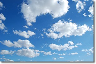
Weather Topic: What are Cumulonimbus Clouds?
Home - Education - Cloud Types - Cumulonimbus Clouds
 Next Topic: Cumulus Clouds
The final form taken by a growing cumulus cloud is the
cumulonimbus cloud, which is very tall and dense.
The tower of a cumulonimbus cloud can soar 23 km into the atmosphere, although
most commonly they stop growing at an altitude of 6 km.
Even small cumulonimbus clouds appear very large in comparison to other cloud types.
They can signal the approach of stormy weather, such as thunderstorms or blizzards.
Next Topic: Cumulus Clouds
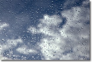
Weather Topic: What is Drizzle?
Home - Education - Precipitation - Drizzle
 Next Topic: Evaporation
Drizzle is precipitation in the form of water droplets which are
smaller than raindrops.
Drizzle is characterized by fine, gently falling droplets and typically does not
impact human habitation in a negative way. The exception to this is freezing drizzle,
a condition where drizzle freezes immediately upon reaching earth's surface.
Freezing drizzle is still less dangerous than freezing rain, but can
potentially result in hazardous road conditions.
Next Topic: Evaporation
Current conditions powered by WeatherAPI.com


