Weather Alert in Michigan
Winter Storm Watch issued March 31 at 3:40PM EDT until April 2 at 8:00PM EDT by NWS Gaylord MI
AREAS AFFECTED: Western Chippewa; Central Chippewa; Southeast Chippewa; Western Mackinac; Eastern Mackinac; Mackinac Island/Bois Blanc Island
DESCRIPTION: * WHAT...Heavy mixed precipitation possible. Total snow and sleet accumulations between 2 and 4 inches and ice accumulations between one tenth and one quarter of an inch possible. Winds could gust 25 to 35 mph from the east. * WHERE...A portion of Eastern Upper Michigan. * WHEN...From late Wednesday night through Thursday evening. * IMPACTS...Plan on slippery road conditions. The hazardous conditions could impact the Thursday morning and evening commutes. * ADDITIONAL DETAILS...Precipitation is expected to start as snow early Thursday morning and continue through midday before transitioning to more sleet and freezing rain during the afternoon. Temperatures are expected to warm above freezing by Thursday evening.
INSTRUCTION: Monitor the latest forecasts for updates on this situation.
Want more detail? Get the Complete 7 Day and Night Detailed Forecast!
Current U.S. National Radar--Current
The Current National Weather Radar is shown below with a UTC Time (subtract 5 hours from UTC to get Eastern Time).

National Weather Forecast--Current
The Current National Weather Forecast and National Weather Map are shown below.

National Weather Forecast for Tomorrow
Tomorrow National Weather Forecast and Tomorrow National Weather Map are show below.

North America Water Vapor (Moisture)
This map shows recent moisture content over North America. Bright and colored areas show high moisture (ie, clouds); brown indicates very little moisture present; black indicates no moisture.

Weather Topic: What is Drizzle?
Home - Education - Precipitation - Drizzle
 Next Topic: Evaporation
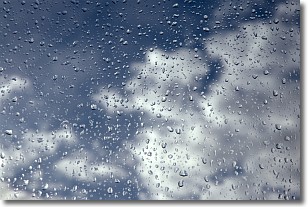
Drizzle is precipitation in the form of water droplets which are
smaller than raindrops.
Drizzle is characterized by fine, gently falling droplets and typically does not
impact human habitation in a negative way. The exception to this is freezing drizzle,
a condition where drizzle freezes immediately upon reaching earth's surface.
Freezing drizzle is still less dangerous than freezing rain, but can
potentially result in hazardous road conditions.
Next Topic: Evaporation
Weather Topic: What is Fog?
Home - Education - Cloud Types - Fog
 Next Topic: Fractus Clouds
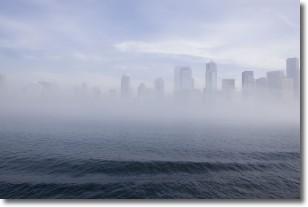
Fog is technically a type of stratus cloud, which lies along the
ground and obscures visibility.
It is usually created when humidity in the air condenses into tiny water droplets.
Because of this, some places are more prone to foggy weather, such as regions
close to a body of water.
Fog is similar to mist; both are the appearance of water droplets suspended in
the air, but fog is the term applied to the condition when visibility is less than 1 km.
Next Topic: Fractus Clouds
Current conditions powered by WeatherAPI.com


