Weather Alert in Florida
Special Weather Statement issued April 29 at 4:07PM EDT by NWS Tallahassee FL
AREAS AFFECTED: Central Walton; Washington; Inland Bay; Calhoun; Inland Gulf; Inland Franklin; Coastal Bay; Northern Liberty; Southern Liberty
DESCRIPTION: At 407 PM EDT/307 PM CDT/, Doppler radar was tracking strong thunderstorms along a line extending from 13 miles southeast of De Funiak Springs to 12 miles east of Stonemill Creek. These storms were nearly stationary. HAZARD...Wind gusts up to 50 mph and half inch hail. SOURCE...Radar indicated. IMPACT...Gusty winds could knock down tree limbs and blow around unsecured objects. Minor hail damage to vegetation is possible. Locations impacted include... Honeyville, Moose Pond, Clarksville, Hiland Park, Abe Springs, Bradford, Vilas, Chipola Cutoff, Dirego Park, College Station, Central City, Orange, Rock Hill, Holmes Valley, Millers Ferry, Scotts Ferry, Bennett, Kern, Porter Lake, and Brannonville.
INSTRUCTION: If outdoors, consider seeking shelter inside a building. These storms may intensify, so be certain to monitor local radio stations and available television stations for additional information and possible warnings from the National Weather Service.
Want more detail? Get the Complete 7 Day and Night Detailed Forecast!
Current U.S. National Radar--Current
The Current National Weather Radar is shown below with a UTC Time (subtract 5 hours from UTC to get Eastern Time).

National Weather Forecast--Current
The Current National Weather Forecast and National Weather Map are shown below.

National Weather Forecast for Tomorrow
Tomorrow National Weather Forecast and Tomorrow National Weather Map are show below.

North America Water Vapor (Moisture)
This map shows recent moisture content over North America. Bright and colored areas show high moisture (ie, clouds); brown indicates very little moisture present; black indicates no moisture.

Weather Topic: What are Altostratus Clouds?
Home - Education - Cloud Types - Altostratus Clouds
 Next Topic: Cirrocumulus Clouds
Altostratus clouds form at mid to high-level altitudes
(between 2 and 7 km) and are created by a warm, stable air mass which causes
water vapor
to condense as it rise through the atmosphere. Usually altostratus clouds are
featureless sheets characterized by a uniform color.
In some cases, wind punching through the cloud formation may give it a waved
appearance, called altostratus undulatus. Altostratus clouds
are commonly seen with other cloud formations accompanying them.
Next Topic: Cirrocumulus Clouds
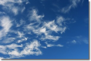
Weather Topic: What are Cirrostratus Clouds?
Home - Education - Cloud Types - Cirrostratus Clouds
 Next Topic: Cirrus Clouds
Cirrostratus clouds are high, thin clouds that form above
20,000 feet and are made mostly of ice crystals. They sometimes look like giant
feathers, horse tails, or curls of hair in the sky.
These clouds are pushed by the jet stream and can move at high speeds reaching
100 mph.
What do they indicate?
They indicate that a precipitation is likely within 24 hours.
Next Topic: Cirrus Clouds
Current conditions powered by WeatherAPI.com


