Weather Alert in Ohio
Severe Thunderstorm Warning issued April 29 at 4:29PM EDT until April 29 at 5:15PM EDT by NWS Cleveland OH
AREAS AFFECTED: Cuyahoga, OH; Geauga, OH; Mahoning, OH; Portage, OH; Stark, OH; Summit, OH; Trumbull, OH
DESCRIPTION: SVRCLE The National Weather Service in Cleveland has issued a * Severe Thunderstorm Warning for... Trumbull County in northeastern Ohio... Mahoning County in northeastern Ohio... Portage County in northeastern Ohio... Southern Geauga County in northeastern Ohio... Southeastern Cuyahoga County in northeastern Ohio... Stark County in northeastern Ohio... Summit County in northeastern Ohio... * Until 515 PM EDT. * At 429 PM EDT, severe thunderstorms were located along a line extending from 6 miles northwest of Cuyahoga Falls to near Waynesburg, moving northeast at 50 mph. HAZARD...60 mph wind gusts and penny size hail. SOURCE...Radar indicated. IMPACT...Expect damage to trees and power lines. * Locations impacted include... Akron, Canton, Youngstown, Warren, Salem, Ravenna, Columbiana, Cuyahoga Falls, Boardman, North Royalton, Kent, Barberton, Green, Solon, Alliance, Hudson, Niles, Twinsburg, Tallmadge, and North Canton.
INSTRUCTION: For your protection move to an interior room on the lowest floor of a building.
Want more detail? Get the Complete 7 Day and Night Detailed Forecast!
Current U.S. National Radar--Current
The Current National Weather Radar is shown below with a UTC Time (subtract 5 hours from UTC to get Eastern Time).

National Weather Forecast--Current
The Current National Weather Forecast and National Weather Map are shown below.

National Weather Forecast for Tomorrow
Tomorrow National Weather Forecast and Tomorrow National Weather Map are show below.

North America Water Vapor (Moisture)
This map shows recent moisture content over North America. Bright and colored areas show high moisture (ie, clouds); brown indicates very little moisture present; black indicates no moisture.

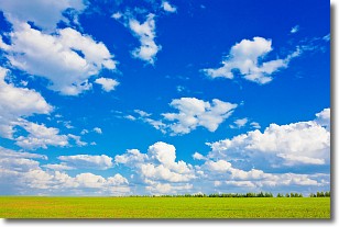
Weather Topic: What are Cumulus Clouds?
Home - Education - Cloud Types - Cumulus Clouds
 Next Topic: Drizzle
Cumulus clouds are fluffy and textured with rounded tops, and
may have flat bottoms. The border of a cumulus cloud
is clearly defined, and can have the appearance of cotton or cauliflower.
Cumulus clouds form at low altitudes (rarely above 2 km) but can grow very tall,
becoming cumulus congestus and possibly the even taller cumulonimbus clouds.
When cumulus clouds become taller, they have a greater chance of producing precipitation.
Next Topic: Drizzle
Weather Topic: What is Evaporation?
Home - Education - Precipitation - Evaporation
 Next Topic: Fog
Evaporation is the process which returns water from the earth
back to the atmosphere, and is another crucial process in the water cycle.
Evaporation is the transformation of liquid into gas, and it happens because
molecules are excited by the application of energy and turn into vapor.
In order for water to evaporate it has to be on the surface of a body of water.
Next Topic: Fog
Current conditions powered by WeatherAPI.com


