Weather Alert in Minnesota
Winter Storm Watch issued March 31 at 2:24PM CDT until April 3 at 1:00AM CDT by NWS Duluth MN
AREAS AFFECTED: Northern Cook/Northern Lake; Central St. Louis; Southern Lake/North Shore; Southern Cook/North Shore; Carlton/South St. Louis; Pine; Douglas; Bayfield; Ashland; Iron
DESCRIPTION: * WHAT...Heavy mixed precipitation possible. Total snow and sleet accumulations between 4 and 9 inches except between 7 and 10 inches for the higher terrain of the North Shore and ice accumulations around one tenth of an inch possible. Winds could gust as high as 35 mph. * WHERE...In Minnesota, Pine, Carlton, South and Central St. Louis, Cook and Lake Counties. In Wisconsin, Ashland, Bayfield, Douglas, and Iron Counties. This includes the Tribal Lands of the Red Cliff Band, the Bois Forte Band, Lake Vermilion area, the Fond du Lac Band, the Grand Portage Reservation, the Bad River Reservation, the northwestern area of the Lac du Flambeau Band and the Mille Lacs Band, Hinckley and, Lena Lake areas. Other locations including the Apostle Islands National Lakeshore and Madeline Island. This also includes the Boundary Waters eastern and central area. * WHEN...From Wednesday evening through late Thursday night. * IMPACTS...Travel could be very difficult. The hazardous conditions could impact the Thursday morning and evening commutes.
INSTRUCTION: Monitor the latest forecasts for updates on this situation.
Want more detail? Get the Complete 7 Day and Night Detailed Forecast!
Current U.S. National Radar--Current
The Current National Weather Radar is shown below with a UTC Time (subtract 5 hours from UTC to get Eastern Time).

National Weather Forecast--Current
The Current National Weather Forecast and National Weather Map are shown below.

National Weather Forecast for Tomorrow
Tomorrow National Weather Forecast and Tomorrow National Weather Map are show below.

North America Water Vapor (Moisture)
This map shows recent moisture content over North America. Bright and colored areas show high moisture (ie, clouds); brown indicates very little moisture present; black indicates no moisture.

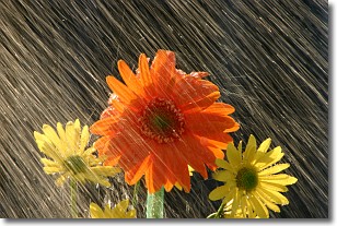
Weather Topic: What is Rain?
Home - Education - Precipitation - Rain
 Next Topic: Shelf Clouds
Precipitation in the form of water droplets is called rain.
Rain generally has a tendency to fall with less intensity over a greater period
of time, and when rainfall is more severe it is usually less sustained.
Rain is the most common form of precipitation and happens with greater frequency
depending on the season and regional influences. Cities have been shown to have
an observable effect on rainfall, due to an effect called the urban heat island.
Compared to upwind, monthly rainfall between twenty and forty miles downwind of
cities is 30% greater.
Next Topic: Shelf Clouds
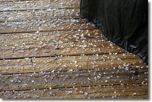
Weather Topic: What is Sleet?
Home - Education - Precipitation - Sleet
 Next Topic: Snow
Sleet is a form of precipitation in which small ice pellets are the primary
components. These ice pellets are smaller and more translucent than hailstones,
and harder than graupel. Sleet is caused by specific atmospheric conditions and
therefore typically doesn't last for extended periods of time.
The condition which leads to sleet formation requires a warmer body of air to be
wedged in between two sub-freezing bodies of air. When snow falls through a warmer
layer of air it melts, and as it falls through the next sub-freezing body of air
it freezes again, forming ice pellets known as sleet. In some cases, water
droplets don't have time to freeze before reaching the surface and the result is
freezing rain.
Next Topic: Snow
Current conditions powered by WeatherAPI.com


