Weather Alert in Minnesota
Winter Storm Watch issued March 31 at 2:24PM CDT until April 3 at 1:00AM CDT by NWS Duluth MN
AREAS AFFECTED: Northern Cook/Northern Lake; Central St. Louis; Southern Lake/North Shore; Southern Cook/North Shore; Carlton/South St. Louis; Pine; Douglas; Bayfield; Ashland; Iron
DESCRIPTION: * WHAT...Heavy mixed precipitation possible. Total snow and sleet accumulations between 4 and 9 inches except between 7 and 10 inches for the higher terrain of the North Shore and ice accumulations around one tenth of an inch possible. Winds could gust as high as 35 mph. * WHERE...In Minnesota, Pine, Carlton, South and Central St. Louis, Cook and Lake Counties. In Wisconsin, Ashland, Bayfield, Douglas, and Iron Counties. This includes the Tribal Lands of the Red Cliff Band, the Bois Forte Band, Lake Vermilion area, the Fond du Lac Band, the Grand Portage Reservation, the Bad River Reservation, the northwestern area of the Lac du Flambeau Band and the Mille Lacs Band, Hinckley and, Lena Lake areas. Other locations including the Apostle Islands National Lakeshore and Madeline Island. This also includes the Boundary Waters eastern and central area. * WHEN...From Wednesday evening through late Thursday night. * IMPACTS...Travel could be very difficult. The hazardous conditions could impact the Thursday morning and evening commutes.
INSTRUCTION: Monitor the latest forecasts for updates on this situation.
Want more detail? Get the Complete 7 Day and Night Detailed Forecast!
Current U.S. National Radar--Current
The Current National Weather Radar is shown below with a UTC Time (subtract 5 hours from UTC to get Eastern Time).

National Weather Forecast--Current
The Current National Weather Forecast and National Weather Map are shown below.

National Weather Forecast for Tomorrow
Tomorrow National Weather Forecast and Tomorrow National Weather Map are show below.

North America Water Vapor (Moisture)
This map shows recent moisture content over North America. Bright and colored areas show high moisture (ie, clouds); brown indicates very little moisture present; black indicates no moisture.

Weather Topic: What is Condensation?
Home - Education - Precipitation - Condensation
 Next Topic: Contrails
Condensation is the process which creates clouds, and therefore
it is a crucial process in the water cycle.
Condensation is the change of matter from a state of gas into a state of liquid,
and it happens because water molecules release heat into the atmosphere and
become organized into a more closely packed structure, what we might see as
water droplets.
Water is always present in the air around us as a vapor, but it's too small for
us to see. When water undergoes the process of condensation it becomes organized
into visible water droplets. You've probably seen condensation happen before on the
surface of a cold drink!
Next Topic: Contrails
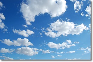
Weather Topic: What are Cumulonimbus Clouds?
Home - Education - Cloud Types - Cumulonimbus Clouds
 Next Topic: Cumulus Clouds
The final form taken by a growing cumulus cloud is the
cumulonimbus cloud, which is very tall and dense.
The tower of a cumulonimbus cloud can soar 23 km into the atmosphere, although
most commonly they stop growing at an altitude of 6 km.
Even small cumulonimbus clouds appear very large in comparison to other cloud types.
They can signal the approach of stormy weather, such as thunderstorms or blizzards.
Next Topic: Cumulus Clouds
Current conditions powered by WeatherAPI.com


