Weather Alert in Oregon
Winter Storm Warning issued March 31 at 9:14PM PDT until April 2 at 5:00PM PDT by NWS Portland OR
AREAS AFFECTED: Cascades of Marion and Linn Counties; Cascades of Lane County
DESCRIPTION: * WHAT...Heavy snow expected. Total snow accumulations between 10 and 18 inches, except 16 to 24 inches above 5500 feet. Winds gusting as high as 40 mph. * WHERE...Cascades of Lane County and Cascades of Marion and Linn Counties. * WHEN...From 5 AM Wednesday to 5 PM PDT Thursday. * IMPACTS...Roads, and especially bridges and overpasses, will likely become slick and hazardous. * ADDITIONAL DETAILS...There is a 25-50% chance for snowfall rates exceeding 1 inch per hour along Santiam and Willamette Passes at any given hour, with the highest chances occurring between 4-7 PM Wednesday and between 3-8 AM Thursday.
INSTRUCTION: Consider postponing travel until weather conditions improve. If you must travel, be sure to slow down and allow extra time. If your car becomes trapped in deep snow, be sure to keep your car off to stay safe from potential carbon monoxide poisoning. If you are using a generator, be sure to keep it outdoors and away from windows and vents. Be aware that walking surfaces may be slick. Walk with extra care. Backcountry recreation is not advised.
Want more detail? Get the Complete 7 Day and Night Detailed Forecast!
Current U.S. National Radar--Current
The Current National Weather Radar is shown below with a UTC Time (subtract 5 hours from UTC to get Eastern Time).

National Weather Forecast--Current
The Current National Weather Forecast and National Weather Map are shown below.

National Weather Forecast for Tomorrow
Tomorrow National Weather Forecast and Tomorrow National Weather Map are show below.

North America Water Vapor (Moisture)
This map shows recent moisture content over North America. Bright and colored areas show high moisture (ie, clouds); brown indicates very little moisture present; black indicates no moisture.

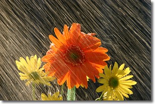
Weather Topic: What is Rain?
Home - Education - Precipitation - Rain
 Next Topic: Shelf Clouds
Precipitation in the form of water droplets is called rain.
Rain generally has a tendency to fall with less intensity over a greater period
of time, and when rainfall is more severe it is usually less sustained.
Rain is the most common form of precipitation and happens with greater frequency
depending on the season and regional influences. Cities have been shown to have
an observable effect on rainfall, due to an effect called the urban heat island.
Compared to upwind, monthly rainfall between twenty and forty miles downwind of
cities is 30% greater.
Next Topic: Shelf Clouds
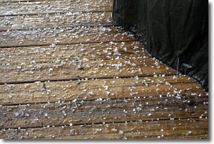
Weather Topic: What is Sleet?
Home - Education - Precipitation - Sleet
 Next Topic: Snow
Sleet is a form of precipitation in which small ice pellets are the primary
components. These ice pellets are smaller and more translucent than hailstones,
and harder than graupel. Sleet is caused by specific atmospheric conditions and
therefore typically doesn't last for extended periods of time.
The condition which leads to sleet formation requires a warmer body of air to be
wedged in between two sub-freezing bodies of air. When snow falls through a warmer
layer of air it melts, and as it falls through the next sub-freezing body of air
it freezes again, forming ice pellets known as sleet. In some cases, water
droplets don't have time to freeze before reaching the surface and the result is
freezing rain.
Next Topic: Snow
Current conditions powered by WeatherAPI.com


