Weather Alert in Colorado
Air Quality Alert issued June 19 at 4:10PM MDT by NWS Denver CO
AREAS AFFECTED: Jefferson, CO; Weld, CO; Adams, CO; Larimer, CO; Arapahoe, CO; Douglas, CO; Boulder, CO; Broomfield, CO; Denver, CO
DESCRIPTION: The Colorado Department of Public Health and Environment has issued the following... WHAT...Ozone Action Day Alert. WHERE...Douglas, Jefferson, Denver, western Arapahoe, western Adams, Broomfield, Boulder, Larimer, and Weld Counties WHEN...400 PM Thursday June 19 to 1200 AM Friday June 20 IMPACTS...Ozone Action Day Alert is now in effect for the Front Range Urban Corridor. Hot, stagnant weather on Thursday will allow ozone to reach the Unhealthy for Sensitive Groups category. The highest ozone concentrations are expected in southern and western portions of the Denver Metro area, along the I-25 corridor towards Fort Collins, and Greeley. Ozone levels will improve to the Good to Moderate range by Friday. For Colorado air quality conditions, forecasts, and advisories, visit: https://www.colorado.gov/airquality/colorado_summary.aspx If possible, please help us reduce ozone pollution by limiting driving gas and diesel-powered vehicles until midnight, Thursday night, June 19, 2025. Colorado is also addressing ozone pollution through state policies. For more information about health impacts and how ozone pollution forms in Colorado, visit: https://cdphe.colorado.gov/ozone- pollution-and-your-health HEALTH INFORMATION...Increasing likelihood of respiratory symptoms and breathing discomfort in active children and adults and people with lung disease, such as asthma. Active children and adults, and people with lung disease, such as asthma, should reduce prolonged or heavy outdoor exertion.
INSTRUCTION: N/A
Want more detail? Get the Complete 7 Day and Night Detailed Forecast!
Current U.S. National Radar--Current
The Current National Weather Radar is shown below with a UTC Time (subtract 5 hours from UTC to get Eastern Time).

National Weather Forecast--Current
The Current National Weather Forecast and National Weather Map are shown below.

National Weather Forecast for Tomorrow
Tomorrow National Weather Forecast and Tomorrow National Weather Map are show below.

North America Water Vapor (Moisture)
This map shows recent moisture content over North America. Bright and colored areas show high moisture (ie, clouds); brown indicates very little moisture present; black indicates no moisture.

Weather Topic: What is Condensation?
Home - Education - Precipitation - Condensation
 Next Topic: Contrails
Condensation is the process which creates clouds, and therefore
it is a crucial process in the water cycle.
Condensation is the change of matter from a state of gas into a state of liquid,
and it happens because water molecules release heat into the atmosphere and
become organized into a more closely packed structure, what we might see as
water droplets.
Water is always present in the air around us as a vapor, but it's too small for
us to see. When water undergoes the process of condensation it becomes organized
into visible water droplets. You've probably seen condensation happen before on the
surface of a cold drink!
Next Topic: Contrails
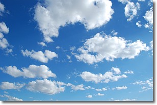
Weather Topic: What are Cumulonimbus Clouds?
Home - Education - Cloud Types - Cumulonimbus Clouds
 Next Topic: Cumulus Clouds
The final form taken by a growing cumulus cloud is the
cumulonimbus cloud, which is very tall and dense.
The tower of a cumulonimbus cloud can soar 23 km into the atmosphere, although
most commonly they stop growing at an altitude of 6 km.
Even small cumulonimbus clouds appear very large in comparison to other cloud types.
They can signal the approach of stormy weather, such as thunderstorms or blizzards.
Next Topic: Cumulus Clouds
Current conditions powered by WeatherAPI.com


