Weather Alert in Kansas
Severe Thunderstorm Warning issued August 3 at 7:37PM CDT until August 3 at 8:15PM CDT by NWS Dodge City KS
AREAS AFFECTED: Finney, KS; Haskell, KS; Kearny, KS
DESCRIPTION: SVRDDC The National Weather Service in Dodge City has issued a * Severe Thunderstorm Warning for... Southeastern Kearny County in southwestern Kansas... Southwestern Finney County in southwestern Kansas... Northwestern Haskell County in southwestern Kansas... * Until 815 PM CDT. * At 736 PM CDT, a severe thunderstorm was located near Holcomb, moving south at 25 mph. HAZARD...Golf ball size hail and 70 mph wind gusts. SOURCE...Emergency management reported golfball hail at Deerfield at 7:35 pm CDT. IMPACT...People and animals outdoors will be injured. Expect hail damage to roofs, siding, windows, and vehicles. Expect considerable tree damage. Wind damage is also likely to mobile homes, roofs, and outbuildings. * This severe thunderstorm will be near... Holcomb around 740 PM CDT.
INSTRUCTION: For your protection move to an interior room on the lowest floor of a building.
Want more detail? Get the Complete 7 Day and Night Detailed Forecast!
Current U.S. National Radar--Current
The Current National Weather Radar is shown below with a UTC Time (subtract 5 hours from UTC to get Eastern Time).

National Weather Forecast--Current
The Current National Weather Forecast and National Weather Map are shown below.

National Weather Forecast for Tomorrow
Tomorrow National Weather Forecast and Tomorrow National Weather Map are show below.

North America Water Vapor (Moisture)
This map shows recent moisture content over North America. Bright and colored areas show high moisture (ie, clouds); brown indicates very little moisture present; black indicates no moisture.

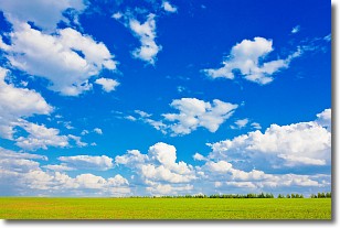
Weather Topic: What are Cumulus Clouds?
Home - Education - Cloud Types - Cumulus Clouds
 Next Topic: Drizzle
Cumulus clouds are fluffy and textured with rounded tops, and
may have flat bottoms. The border of a cumulus cloud
is clearly defined, and can have the appearance of cotton or cauliflower.
Cumulus clouds form at low altitudes (rarely above 2 km) but can grow very tall,
becoming cumulus congestus and possibly the even taller cumulonimbus clouds.
When cumulus clouds become taller, they have a greater chance of producing precipitation.
Next Topic: Drizzle
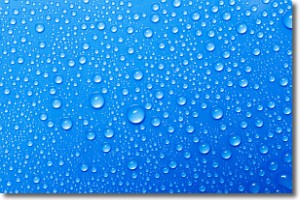
Weather Topic: What is Evaporation?
Home - Education - Precipitation - Evaporation
 Next Topic: Fog
Evaporation is the process which returns water from the earth
back to the atmosphere, and is another crucial process in the water cycle.
Evaporation is the transformation of liquid into gas, and it happens because
molecules are excited by the application of energy and turn into vapor.
In order for water to evaporate it has to be on the surface of a body of water.
Next Topic: Fog
Current conditions powered by WeatherAPI.com


