Weather Alert in Wisconsin
Winter Storm Watch issued March 31 at 8:49PM CDT until April 2 at 1:00PM CDT by NWS Green Bay WI
AREAS AFFECTED: Lincoln; Langlade; Menominee; Northern Oconto County; Marathon; Shawano; Southern Marinette County; Southern Oconto County
DESCRIPTION: * WHAT...Heavy sleet and freezing rain possible. Total snow and sleet accumulations of 1 to 2 inches and ice accumulations between 1/4 and 1/2 inch possible. * WHERE...Marathon, Langlade, Lincoln, Menominee, Northern Oconto County, Shawano, Southern Marinette County, and Southern Oconto counties. * WHEN...From late Wednesday night through Thursday afternoon. * IMPACTS...Significant ice accumulation on power lines and tree limbs may cause tree damage and power outages. Travel could be nearly impossible. The hazardous conditions will likely impact the Thursday morning commute.
INSTRUCTION: Monitor the latest forecasts for updates on this situation. People should consider delaying all travel. If travel is absolutely necessary, drive with extreme caution. Consider taking a winter storm kit along with you, including such items as tire chains, booster cables, flashlight, shovel, blankets and extra clothing. Also take water, a first aid kit, and anything else that would help you survive in case you become stranded.
Want more detail? Get the Complete 7 Day and Night Detailed Forecast!
Current U.S. National Radar--Current
The Current National Weather Radar is shown below with a UTC Time (subtract 5 hours from UTC to get Eastern Time).

National Weather Forecast--Current
The Current National Weather Forecast and National Weather Map are shown below.

National Weather Forecast for Tomorrow
Tomorrow National Weather Forecast and Tomorrow National Weather Map are show below.

North America Water Vapor (Moisture)
This map shows recent moisture content over North America. Bright and colored areas show high moisture (ie, clouds); brown indicates very little moisture present; black indicates no moisture.

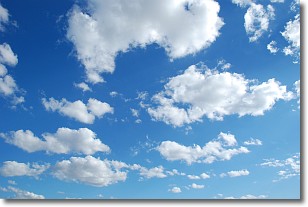
Weather Topic: What are Cumulonimbus Clouds?
Home - Education - Cloud Types - Cumulonimbus Clouds
 Next Topic: Cumulus Clouds
The final form taken by a growing cumulus cloud is the
cumulonimbus cloud, which is very tall and dense.
The tower of a cumulonimbus cloud can soar 23 km into the atmosphere, although
most commonly they stop growing at an altitude of 6 km.
Even small cumulonimbus clouds appear very large in comparison to other cloud types.
They can signal the approach of stormy weather, such as thunderstorms or blizzards.
Next Topic: Cumulus Clouds
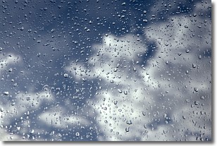
Weather Topic: What is Drizzle?
Home - Education - Precipitation - Drizzle
 Next Topic: Evaporation
Drizzle is precipitation in the form of water droplets which are
smaller than raindrops.
Drizzle is characterized by fine, gently falling droplets and typically does not
impact human habitation in a negative way. The exception to this is freezing drizzle,
a condition where drizzle freezes immediately upon reaching earth's surface.
Freezing drizzle is still less dangerous than freezing rain, but can
potentially result in hazardous road conditions.
Next Topic: Evaporation
Current conditions powered by WeatherAPI.com


