Weather Alert in New York
Flood Warning issued March 31 at 11:05PM EDT until April 1 at 5:27PM EDT by NWS Buffalo NY
AREAS AFFECTED: Erie, NY; Wyoming, NY
DESCRIPTION: ...Forecast flooding changed from Minor to Moderate severity and increased in duration for the following rivers in New York... Cayuga Creek Near Lancaster affecting Erie and Wyoming Counties. For the Cayuga Creek...including Lancaster...Moderate flooding is forecast. * WHAT...Minor flooding is occurring and moderate flooding is forecast. * WHERE...Cayuga Creek near Lancaster. * WHEN...From this evening to Wednesday afternoon. * IMPACTS...At 10.0 feet, Moderate flood, flooding of backyards, basements and streets in Village of Lancaster. Some flooding of low lying areas in Alden, Marilla, and Cheektowaga, especially near Bowen Road and Transit Road. Some flooding possible near Union Road too. * ADDITIONAL DETAILS... - At 10:30 PM EDT Tuesday the stage was 8.84 feet. - Bankfull stage is 8.0 feet. - Recent Activity...The maximum river stage in the 24 hours ending at 10:30 PM EDT Tuesday was 8.84 feet. - Forecast...The river is expected to rise to a crest of 10.2 feet just after midnight tonight. It will then fall below flood stage late tomorrow morning. - Flood stage is 8.0 feet. - Flood History...This crest compares to a previous crest of 10.1 feet on 06/23/1972. - http://www.weather.gov/safety/flood
INSTRUCTION: Turn around, don't drown when encountering flooded roads. Most flood deaths occur in vehicles. Be especially cautious at night when it is harder to recognize the dangers of flooding. Caution is urged when walking near riverbanks. Additional information is available at www.weather.gov. The next statement will be issued Wednesday morning by 1115 AM EDT.
Want more detail? Get the Complete 7 Day and Night Detailed Forecast!
Current U.S. National Radar--Current
The Current National Weather Radar is shown below with a UTC Time (subtract 5 hours from UTC to get Eastern Time).

National Weather Forecast--Current
The Current National Weather Forecast and National Weather Map are shown below.

National Weather Forecast for Tomorrow
Tomorrow National Weather Forecast and Tomorrow National Weather Map are show below.

North America Water Vapor (Moisture)
This map shows recent moisture content over North America. Bright and colored areas show high moisture (ie, clouds); brown indicates very little moisture present; black indicates no moisture.

Weather Topic: What is Drizzle?
Home - Education - Precipitation - Drizzle
 Next Topic: Evaporation
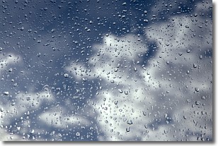
Drizzle is precipitation in the form of water droplets which are
smaller than raindrops.
Drizzle is characterized by fine, gently falling droplets and typically does not
impact human habitation in a negative way. The exception to this is freezing drizzle,
a condition where drizzle freezes immediately upon reaching earth's surface.
Freezing drizzle is still less dangerous than freezing rain, but can
potentially result in hazardous road conditions.
Next Topic: Evaporation
Weather Topic: What is Fog?
Home - Education - Cloud Types - Fog
 Next Topic: Fractus Clouds
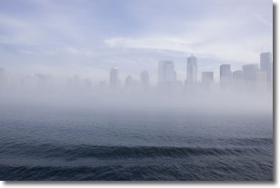
Fog is technically a type of stratus cloud, which lies along the
ground and obscures visibility.
It is usually created when humidity in the air condenses into tiny water droplets.
Because of this, some places are more prone to foggy weather, such as regions
close to a body of water.
Fog is similar to mist; both are the appearance of water droplets suspended in
the air, but fog is the term applied to the condition when visibility is less than 1 km.
Next Topic: Fractus Clouds
Current conditions powered by WeatherAPI.com


