Weather Alert in Ohio
Flood Warning issued April 1 at 12:50AM EDT until April 1 at 6:00AM EDT by NWS Cleveland OH
AREAS AFFECTED: Cuyahoga, OH; Geauga, OH; Lake, OH
DESCRIPTION: * WHAT...Flooding caused by excessive rainfall is expected. * WHERE...A portion of northeast Ohio, including the following counties, Cuyahoga, Geauga and Lake. * WHEN...Until 600 AM EDT. * IMPACTS...Numerous roads remain closed due to flooding. Expect many areas of slow moving or standing water. It will take several hours for all the water from these storms to work through local drainage systems in urban areas. * ADDITIONAL DETAILS... - At 1250 AM EDT, local law enforcement reported heavy rain in the warned area due to thunderstorms. Flooding is ongoing or expected to begin shortly. Between 2 and 3.5 inches of rain have fallen. - Additional rainfall amounts up to 0.3 inches are possible in the warned area. - Some locations that will experience flooding include... Cleveland, Willowick, Euclid, Mentor, Cleveland Heights, Willoughby, Eastlake, Chesterland, South Euclid, Mayfield Heights, East Cleveland, Lyndhurst, Wickliffe, Richmond Heights, Willoughby Hills, Highland Heights, Kirtland, Mayfield, Gates Mills and Bratenahl. - Please visit www.weather.gov/safety/flood for flood safety and preparedness information.
INSTRUCTION: Turn around, don't drown when encountering flooded roads. Most flood deaths occur in vehicles. Be especially cautious at night when it is harder to recognize the dangers of flooding. Stay away or be swept away. River banks and culverts can become unstable and unsafe.
Want more detail? Get the Complete 7 Day and Night Detailed Forecast!
Current U.S. National Radar--Current
The Current National Weather Radar is shown below with a UTC Time (subtract 5 hours from UTC to get Eastern Time).

National Weather Forecast--Current
The Current National Weather Forecast and National Weather Map are shown below.

National Weather Forecast for Tomorrow
Tomorrow National Weather Forecast and Tomorrow National Weather Map are show below.

North America Water Vapor (Moisture)
This map shows recent moisture content over North America. Bright and colored areas show high moisture (ie, clouds); brown indicates very little moisture present; black indicates no moisture.

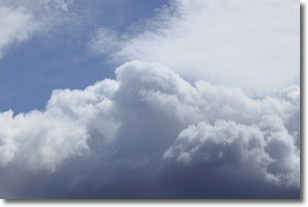
Weather Topic: What are Nimbostratus Clouds?
Home - Education - Cloud Types - Nimbostratus Clouds
 Next Topic: Precipitation
A nimbostratus cloud is similar to a stratus cloud in its formless,
smooth appearance. However, a nimbostratus cloud is darker than a stratus cloud,
because it is thicker.
Unlike a stratus cloud, a nimbostratus cloud typically brings with it the threat
of moderate to heavy precipitation. In some cases, the precipitation may evaporate
before reaching the ground, a phenomenon known as virga.
Next Topic: Precipitation
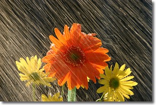
Weather Topic: What is Rain?
Home - Education - Precipitation - Rain
 Next Topic: Shelf Clouds
Precipitation in the form of water droplets is called rain.
Rain generally has a tendency to fall with less intensity over a greater period
of time, and when rainfall is more severe it is usually less sustained.
Rain is the most common form of precipitation and happens with greater frequency
depending on the season and regional influences. Cities have been shown to have
an observable effect on rainfall, due to an effect called the urban heat island.
Compared to upwind, monthly rainfall between twenty and forty miles downwind of
cities is 30% greater.
Next Topic: Shelf Clouds
Current conditions powered by WeatherAPI.com


