Weather Alert in Wisconsin
Winter Storm Watch issued March 31 at 2:50PM CDT until April 2 at 7:00PM CDT by NWS Twin Cities/Chanhassen MN
AREAS AFFECTED: Polk; Barron; Rusk; St. Croix; Pierce; Dunn; Pepin; Chippewa; Eau Claire
DESCRIPTION: ...MESSY SPRING SYSTEM TO BRING RAIN, FREEZING RAIN, SLEET, AND SNOW TO PORTIONS OF MINNESOTA AND WISCONSIN WEDNESDAY THROUGH THURSDAY... .A strong system is expected to bring a variety of precipitation types to the region Wednesday through Thursday. While there is still some uncertainty in the exact track of the low, a mix of snow and sleet is expected for much of central and western Minnesota. Further to the south and east, sleet and freezing rain will be the primary precipitation type. Some shifts in the track are still anticipated, which will influence the total accumulations of snow, sleet, freezing rain, and rain. * WHAT...Heavy mixed precipitation possible. Total snow accumulations up to two inches, sleet accumulations around 1 inch, and ice accumulations up to two tenths of an inch possible. * WHERE...Barron, Polk, Rusk, Chippewa, Dunn, Eau Claire, Pepin, Pierce, and St. Croix Counties. * WHEN...From Wednesday evening through Thursday evening. * IMPACTS...Plan on slippery road conditions. The hazardous conditions could impact the Wednesday evening and Thursday morning commutes.
INSTRUCTION: Monitor the latest forecasts for updates on this situation.
Want more detail? Get the Complete 7 Day and Night Detailed Forecast!
Current U.S. National Radar--Current
The Current National Weather Radar is shown below with a UTC Time (subtract 5 hours from UTC to get Eastern Time).

National Weather Forecast--Current
The Current National Weather Forecast and National Weather Map are shown below.

National Weather Forecast for Tomorrow
Tomorrow National Weather Forecast and Tomorrow National Weather Map are show below.

North America Water Vapor (Moisture)
This map shows recent moisture content over North America. Bright and colored areas show high moisture (ie, clouds); brown indicates very little moisture present; black indicates no moisture.

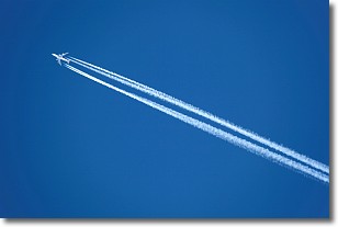
Weather Topic: What are Contrails?
Home - Education - Cloud Types - Contrails
 Next Topic: Cumulonimbus Clouds
A contrail is an artificial cloud, created by the passing of an
aircraft.
Contrails form because water vapor in the exhaust of aircraft engines is suspended
in the air under certain temperatures and humidity conditions. These contrails
are called exhaust contrails.
Another type of contrail can form due to a temporary reduction in air pressure
moving over the plane's surface, causing condensation.
These are called aerodynamic contrails.
When you can see your breath on a cold day, it is also because of condensation.
The reason contrails last longer than the condensation from your breath is
because the water in contrails freezes into ice particles.
Next Topic: Cumulonimbus Clouds
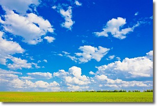
Weather Topic: What are Cumulus Clouds?
Home - Education - Cloud Types - Cumulus Clouds
 Next Topic: Drizzle
Cumulus clouds are fluffy and textured with rounded tops, and
may have flat bottoms. The border of a cumulus cloud
is clearly defined, and can have the appearance of cotton or cauliflower.
Cumulus clouds form at low altitudes (rarely above 2 km) but can grow very tall,
becoming cumulus congestus and possibly the even taller cumulonimbus clouds.
When cumulus clouds become taller, they have a greater chance of producing precipitation.
Next Topic: Drizzle
Current conditions powered by WeatherAPI.com


