Weather Alert in Minnesota
Winter Weather Advisory issued March 31 at 2:50PM CDT until April 2 at 7:00PM CDT by NWS Twin Cities/Chanhassen MN
AREAS AFFECTED: Sherburne; Isanti; Chisago; Wright; Hennepin; Anoka; Ramsey; Washington; Renville; McLeod; Sibley; Carver; Scott; Dakota; Redwood; Brown; Nicollet; Le Sueur; Rice; Goodhue; Watonwan; Blue Earth; Waseca; Steele
DESCRIPTION: ...MESSY SPRING SYSTEM TO BRING RAIN, FREEZING RAIN, SLEET, AND SNOW TO PORTIONS OF MINNESOTA AND WISCONSIN WEDNESDAY THROUGH THURSDAY... .A strong system is expected to bring a variety of precipitation types to the region Wednesday through Thursday. While there is still some uncertainty in the exact track of the low, a mix of snow and sleet is expected for much of central and western Minnesota. Further to the south and east, sleet and freezing rain will be the primary precipitation type. Some shifts in the track are still anticipated, which will influence the total accumulations of snow, sleet, freezing rain, and rain. * WHAT...Mixed precipitation expected. Total snow accumulations up to 3 inches, sleet accumulations around 1 inch, and ice accumulations up to one tenth of an inch. * WHERE...Portions of central, east central, south central, southeast, and southwest Minnesota. * WHEN...From 7 PM Wednesday to 7 PM CDT Thursday. * IMPACTS...Plan on slippery road conditions. The hazardous conditions will impact the Wednesday evening and Thursday morning commutes.
INSTRUCTION: Slow down and use caution while traveling. Call 5 1 1 or visit 511mn.org for road conditions.
Want more detail? Get the Complete 7 Day and Night Detailed Forecast!
Current U.S. National Radar--Current
The Current National Weather Radar is shown below with a UTC Time (subtract 5 hours from UTC to get Eastern Time).

National Weather Forecast--Current
The Current National Weather Forecast and National Weather Map are shown below.

National Weather Forecast for Tomorrow
Tomorrow National Weather Forecast and Tomorrow National Weather Map are show below.

North America Water Vapor (Moisture)
This map shows recent moisture content over North America. Bright and colored areas show high moisture (ie, clouds); brown indicates very little moisture present; black indicates no moisture.

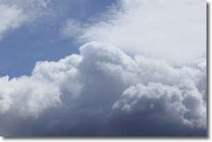
Weather Topic: What are Nimbostratus Clouds?
Home - Education - Cloud Types - Nimbostratus Clouds
 Next Topic: Precipitation
A nimbostratus cloud is similar to a stratus cloud in its formless,
smooth appearance. However, a nimbostratus cloud is darker than a stratus cloud,
because it is thicker.
Unlike a stratus cloud, a nimbostratus cloud typically brings with it the threat
of moderate to heavy precipitation. In some cases, the precipitation may evaporate
before reaching the ground, a phenomenon known as virga.
Next Topic: Precipitation
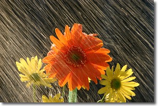
Weather Topic: What is Rain?
Home - Education - Precipitation - Rain
 Next Topic: Shelf Clouds
Precipitation in the form of water droplets is called rain.
Rain generally has a tendency to fall with less intensity over a greater period
of time, and when rainfall is more severe it is usually less sustained.
Rain is the most common form of precipitation and happens with greater frequency
depending on the season and regional influences. Cities have been shown to have
an observable effect on rainfall, due to an effect called the urban heat island.
Compared to upwind, monthly rainfall between twenty and forty miles downwind of
cities is 30% greater.
Next Topic: Shelf Clouds
Current conditions powered by WeatherAPI.com


