Weather Alert in Minnesota
Extreme Heat Warning issued June 19 at 2:45PM CDT until June 22 at 9:00PM CDT by NWS Twin Cities/Chanhassen MN
AREAS AFFECTED: Stevens; Swift; Kandiyohi; Meeker; McLeod; Sibley; Le Sueur; Waseca
DESCRIPTION: * WHAT...For the Heat Advisory, heat index values up to 100 expected. For the Extreme Heat Warning, dangerously hot conditions with heat index values of 105 to 110 expected. Low temperatures Friday night and Saturday night will remain in the mid 70s to lower 80s, providing little relief from the heat. * WHERE...Kandiyohi, McLeod, Meeker, Sibley, Le Sueur, Waseca, Stevens, and Swift Counties. * WHEN...For the Heat Advisory, from 2 PM Friday to noon CDT Saturday. For the Extreme Heat Warning, from noon Saturday to 9 PM CDT Sunday. * IMPACTS...Heat-related illnesses increase significantly during extreme heat and high humidity events. Hot temperatures and high humidity may cause heat illnesses.
INSTRUCTION: Drink plenty of fluids, stay in an air-conditioned room, stay out of the sun, and check up on relatives and neighbors. Do not leave young children and pets in unattended vehicles. Car interiors will reach lethal temperatures in a matter of minutes. Take extra precautions when outside. Wear lightweight and loose fitting clothing. Try to limit strenuous activities to early morning or evening. Take action when you see symptoms of heat exhaustion and heat stroke.
Want more detail? Get the Complete 7 Day and Night Detailed Forecast!
Current U.S. National Radar--Current
The Current National Weather Radar is shown below with a UTC Time (subtract 5 hours from UTC to get Eastern Time).

National Weather Forecast--Current
The Current National Weather Forecast and National Weather Map are shown below.

National Weather Forecast for Tomorrow
Tomorrow National Weather Forecast and Tomorrow National Weather Map are show below.

North America Water Vapor (Moisture)
This map shows recent moisture content over North America. Bright and colored areas show high moisture (ie, clouds); brown indicates very little moisture present; black indicates no moisture.

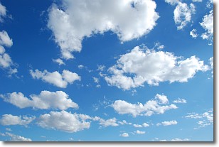
Weather Topic: What are Cumulonimbus Clouds?
Home - Education - Cloud Types - Cumulonimbus Clouds
 Next Topic: Cumulus Clouds
The final form taken by a growing cumulus cloud is the
cumulonimbus cloud, which is very tall and dense.
The tower of a cumulonimbus cloud can soar 23 km into the atmosphere, although
most commonly they stop growing at an altitude of 6 km.
Even small cumulonimbus clouds appear very large in comparison to other cloud types.
They can signal the approach of stormy weather, such as thunderstorms or blizzards.
Next Topic: Cumulus Clouds
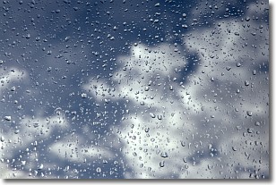
Weather Topic: What is Drizzle?
Home - Education - Precipitation - Drizzle
 Next Topic: Evaporation
Drizzle is precipitation in the form of water droplets which are
smaller than raindrops.
Drizzle is characterized by fine, gently falling droplets and typically does not
impact human habitation in a negative way. The exception to this is freezing drizzle,
a condition where drizzle freezes immediately upon reaching earth's surface.
Freezing drizzle is still less dangerous than freezing rain, but can
potentially result in hazardous road conditions.
Next Topic: Evaporation
Current conditions powered by WeatherAPI.com


